A handsome 1940 / WW2 Arts& Craft illuminated Glass Globe


A handsome 1940 / WW2 Arts& Craft illuminated Glass Globe
$0.00
This attractive artifact offers the warmth and handsome simplicity of the Arts and Craft Movement, while the detailed map shares the horrific history of WW2.
The German Regime has conquered and occupied parts of Europe as the Japanese Empire has overtaken parts of China’s mainland. Italy has expanded into Africa, documented by Italian East Africa on the map. A territory that existed for only a few years: 1936-41.
An exquisite décor of understated elegance, offering immense history to be discovered.
When illuminated, the sphere provides a warm, intimate glow as only a vintage globe can. Made of hand blown glass, covered by 12 individual, hand applied paper strips making up the map, this artifact celebrates the long lost art of globe making at its best.
About the manufacture:
What was to become the George F. Cram Company was founded in 1867 by Rufus Blanchard and George Franklin Cram (uncle and nephew) in Evanston, Illinois. The firm was known as Blanchard and Cram and was engaged in producing atlases and maps. By 1869 the business had become George F. Cram, with Cram taking full control and moved to Chicago that same year. The great Chicago fire destroyed the business, which was reestablished under the name Cram Map Depot. In 1921 Cram sold the company to E. A. Peterson. Peterson merged the Cram Company with his National Map Company, and in 1928 it became The George F. Cram Company. The year 1928 also saw the death of founder George F. Cram at the age of 86.
The company began making globes in c 1931-32, and in 1936 relocated to Indianapolis. In 1966 Loren B. Douthit, an employee since 1937, became President of the company until his retirement in 1978. William and John Douthit, Loren's sons, assumed management of the company the same year. When Loren B. Douthit died in 1996, William L. Douthit was named Chairman of the Board.
Herff Jones, which owns the Nystrom line of globes, purchased CRAM in 2005. Douthit family members are still involved in creating globes at the Herff Jones facility in Indianapolis.
To differ itself from the other great Chicago Globe makers in the early 2oth century and to be competitive, Cram became very creative early on. The company experimented with mountings and colors. As a result, the company produced some of the most unique globes.
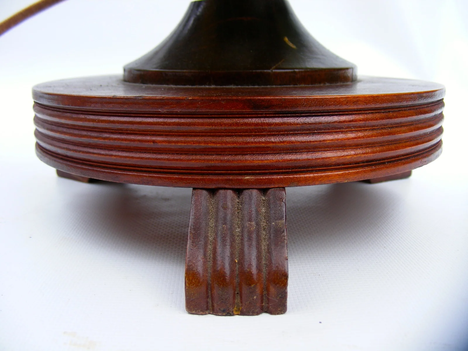
The 10.5 inch diameter glass orb is covered with 12 individual paper gores representing the map and mounted onto a beautiful oak base with a classic arts and craft design and a cast metal, numeric half meridian with gold finish. The map identifies shipping routes, rivers and railways in addition to political borders. Total height of about 15 inches. Lighting can be illuminated via pull chain.
The Globe is in very good condition. Some minor scuffing and soiling, age appropriate.. Details though are still very crisp. Colors overall are vivid and very warm. The base and meridian are in good condition, no cracks or any other damage, some minor scuffing. Lighting is functional and offers a beautiful, warm ambiance.
The age of the Globe has been determined by the political borders displayed, which are as follows:
Europe:
Europe is shown during the height of WWII. Austria has been annexed by Germany (1938). Czechoslovakia is no longer in existence as Germany has seized part of what’s today the Czech Republic (1939). The Islands of Cyprus and Malta are shown to be under British control. The Irish Free State is displayed with Dublin as its Capital. It also shows Dublin in its native name, Baile Atha Cliat.
Middle East-Asia:
Persia has changed to Iran (1935). Palestine is shown instead of Israel(1948). Instead of Indonesia the Netherlands East Indies are shown. Today’s Malaysia is shown as the Malay States. Vietnam, Laos and Cambodia are shown as French Indochina. The area of Manchuria in China is also shown in its original name as well as Manchoukuo and occupied by Japan. (1932-45).
Africa:
Colonies are displayed as follows: French West as well as Equatorial Africa, Angelo-Egyptian Sudan and the Belgian Congo are shown; Rhodesia is divided into North and South. Italian East Africa is displayed. (1936-41)
Clearly displaying the effects of World War 2, the map shares a Europe in fear of the ever so expanding German Empire as the Allied Forces gather to strike back. An interesting object for any History Buff or Admirer of the beautiful design of the Arts& Craft (aka Mission) style design movement.
Well packed, domestic shipping is $22 ,International $65 (Most countries)
$349 - Item # 814CRACIL40
sold out